

.jpg)


1. Wat Maha Buddharam (วัดมหาพุทธาราม) .jpg)
Located in the heart of Si Sa Ket city, the Buddhist temple’s vihara houses ‘Luang Po To’ the sacred icon of Si Sa Ket. Built during Khmer era over a thousand years ago, the statue was originally carved from stone and decorated later at unknown time.
GPS : 15.1177012,104.3286579
2. Somdet Phra Srinakarindra Park (สวนสมเด็จพระศรีนครินทร์) 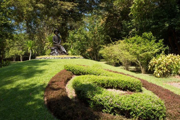
Located in Agricutural Collage Si Sa Ket, Kasikam Road., Tambon Nong Krok, a couple kilometres from the city hall. With landscape of rolling hill, the park is nourished by two streams, Huai Pun Yai and Huai Pun Noi that meet north of the park. Here is rich of Lamduan Tree, making it a nice place for botanical excursion. The lush forest of Lamduan always fills up the air with fragrance every March. As Si Sa Ket was also formerly called Si Nakhon Lamduan, Lamdman tree is used as logo of the province. Zoo, beautifully landscaped garden, and big pond in the park make it nice place for relaxing.
GPS : 15.1013378,104.3083533
3. Ban Khun Ampai Phanit (บ้านขุนอำไพพาณิชย์) 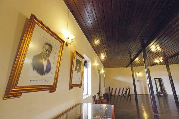
Located in Ubon Road., the beautiful building belongs to Si Sa Ket nobleman Khun Amphai Phanit (In Naga-siharat). Built by Chinese and Mon technicians in 1925, the Chinese style building was gracefully decorated with stucco. It is well renovated and preserved, and eventually won gold medal in the project of conversing urban architecture in 1988. The Fine Art Department has registered the building as ancient building already.
GPS : 15.114445,104.332376
4. Phra That Rueang Rong (พระธาตุเรืองรอง) 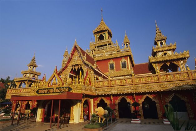
Located at Ban Sang Rueang, Tambon Yaplong, the temple’s architecture is the gracefully blending of art from four ethnic groups in Lower Northeast namely Lao, Suai, and Yoe.
GPS : 15.1659401,104.2988062
5. Khao Phra Wihan National Park (อุทยานแห่งชาติเขาพระวิหาร) 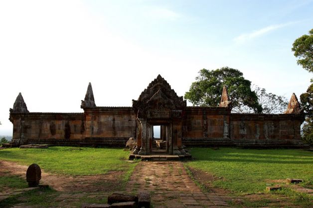
The park’s territory lines Thailand-Cambodia border, over high cliff and lush forest of Dongrak Range. Khao Phra Wihan National Park acquires area of Amphoe Kantharalak of Si Sa Ket.
Other Places of Interest in Khao Phra Wihan National Park:
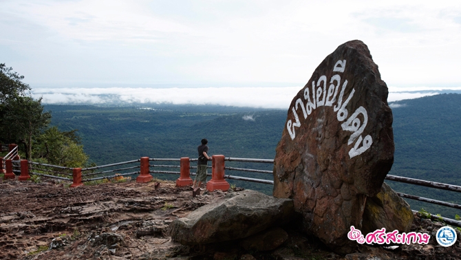
Pha Mo E-Daeng (ผามออีแดง) One of the best bird’s eye view point of Northeast, the red-colour rock cliff is situated right on Thailand-Cambodia border with a height of 556 meters above sea level. It offers panoramic view of vast Cambodian forest and Preah Vihear Sanctuary.
Bas relief (ภาพสลักนูนต่ำ) Situated south of Pha Mo E-Daeng, the bas relief carved on the red- sandstone cliff depicts three gods in Khmer style. Khmer craftsmen probably practiced here first before the real carving at Preah Vihear Sanctuary.
GPS : 14.432062,104.6858804
6.Sa Kamphaeng Yai Khmer Ruins. (ปราสาทสระกำแพงใหญ่) 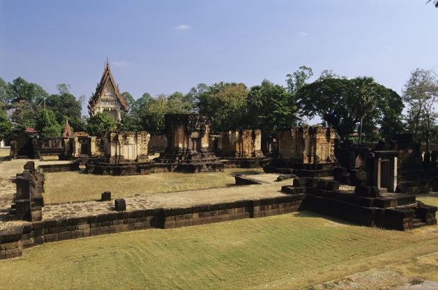
Located in Wat Sa Kampaeng Yai, Ban Kampaeng Yai, Tambon Sa Kampaeng Yai, it is the biggest and most perfect Khmer Ruins in the province. The Khmer Ruins comprises three stupas on the same base lining in North-South direction and facing east. The main stupa, at the middle, made from sandstone and bricks in some part, houses carved lintel depicting God Indra on the back of Erawan Heavenly Elephant above the kirtimukha. Other two stupas are made of brick with sandstone decorations such as lintel, gable frame and door frame.
GPS : 15.101896,104.1281713
 “ประเสริฐ” รองนายกฯ หนุน สสส.ผนึกกำลัง 7 หน่วยงาน ตั้ง “ภาคีอาสาจังหวัดเข้มแข็ง” ดัน 5 จังหวัดนำร่อง ขยายผล 13 เขตสุขภาพ ลดป่วย-เหลื่อมล้ำ เพิ่มเข้าถึงบริการสุขภาพ ภายในปี 69 ฝาก สสส.สื่อสารขายบุหรี่ไฟฟ้า ผิดกม.อาชญากรรมทางไซเบอร์
...
 ประกาศกรมอุตุนิยมวิทยา 'พายุฤดูร้อนบริเวณประเทศไทยตอนบน' ฉบับที่ 6
...
 รฟม. แจ้งปิดเบี่ยงจราจรชั่วคราว ฝั่งขาออก 2 ช่องจราจร ชิดฟุตบาท บนถนนสุขสวัสดิ์ บริเวณซอยสุขสวัสดิ์ 27 วันที่ 3 พฤษภาคม 2568 เฉพาะเวลา 23.00 - 04.00 น.
...


